
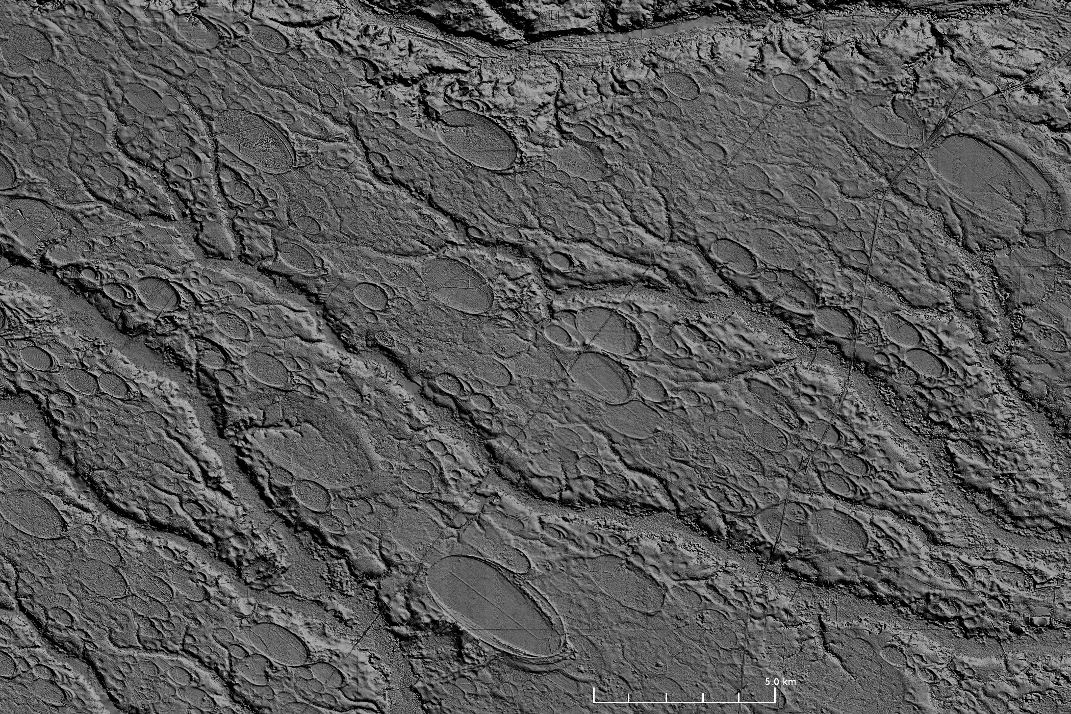
Carolina Bays, 25 km southwest from Fayetteville, NC (Lat. 34.88, Lon.−79.05). The image covers an area of ~550 km2 with an elevation of 76 m above sea level in the upper left and 16 m in the lower right. The image was prepared with the Global Mapper GIS application using 1/9 arc-second LiDAR from the USGS National Elevation Dataset (NED).
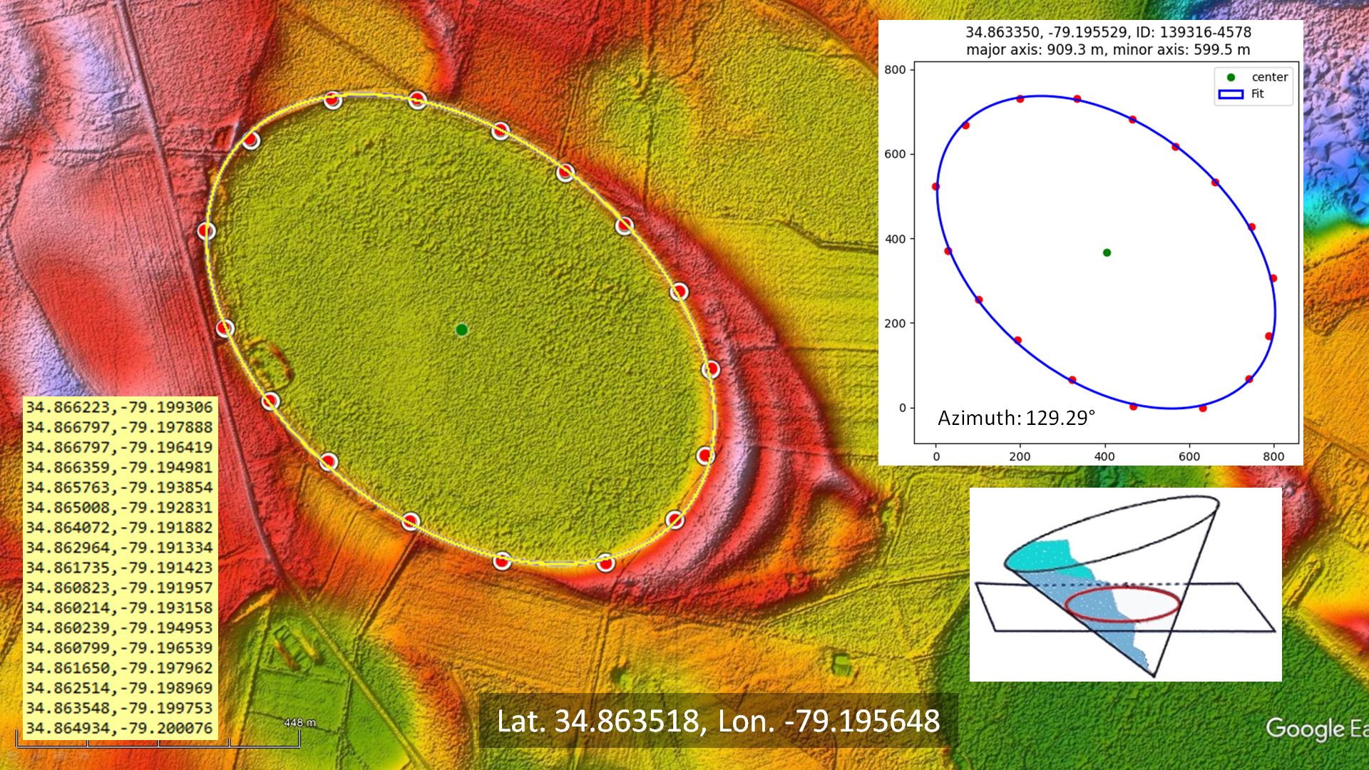
The Carolina Bays can be fitted with ellipses by selecting points around the perimeter of the bay and fitting the points with an ellipse by the least squares method. The geometry of well-preserved Carolina Bays differs by less than 3% from mathematical ellipses. This helps to support the hypothesis that the Carolina Bays originated as inclined conical cavities. The Glacier Ice Impact Hypothesis (Zamora, 2017) proposes that the Carolina Bays originated from secondary oblique impacts of glacier ice ejected by an extraterrestrial impact on the Laurentide Ice Sheet.